


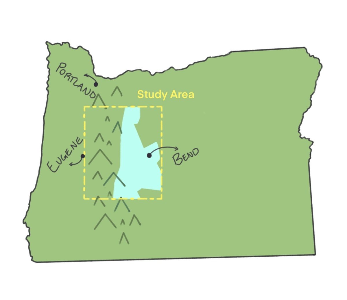
University of Oregon scientists and partners published a study on Jan. 13; the study said they found an aquifer running underneath the Oregon Cascades, which indicated to be many times larger than previously estimated — at least 81 cubic kilometers.
“It’s (aquifer) around three times the size of Lake Meade when full,” Alex Simpson, UO graduate hydrogeology student and co-author of the study, said. “It’s on the scale of Lake Tahoe and Lake Geneva and we (scientists) didn’t really know about it at all.”
According to the study, the aquifer is trapped beneath the surface by porous volcanic rock, which accumulates over time and helps regulate climate, river flow and more.
The study also said the scale of the discovery has implications in several disciplines including agriculture, a field increasingly utilizing groundwater for irrigation.
“(The aquifer) will definitely attract a lot of people, a lot of farmers. Of course people will want to increase their farm, acres, etc., etc.,” Jean Faye, instructor of natural sciences, said. “There’s a lot of talk that Oregon will become the next California in terms of agricultural productivity.”
According to Simpson, there has long been a consensus that water lies beneath the surface, but the scale of the discovery was significant.
“We’ve known (since) the 1900s about some weird hydrology (in Oregon),” Simpson said. “The new discovery was that (the aquifer) far surpassed our previous expectation.”
According to Simpson, the aquifer lies partly beneath the United States Forest Service land, but the rest is mostly in agricultural territory.
This could impact farmers, roughly half of whom draw water from underground in the U.S., according to the U.S. Department of Agriculture.
“Surface water is not enough. If you want to irrigate acres and acres of agricultural land, it will require more water because… agriculture is not just reli(ant) on the rain to irrigate,” Faye said. “Most of agriculture in the U.S. taps into the groundwater to irrigate the crops.”
Leif Karlstrom, UO associate professor in earth sciences and co-author of the study, said the recent study provides a good starting place for understanding the hydrology and geology of the area.
“What we’re doing is sort of providing the context that maybe allows decisions (about water use) to be made in a more intelligent way. Because knowing (how much water is in this aquifer) could certainly have an impact for all those things downstream like habitat and agriculture,” Karlstrom said.
According to Simpson, the study was limited by drilling methods, which could mean the estimated scale is lower bound and the true size of the underground reservoir could stretch beyond the Oregon borders.
“There (are) also similar systems in Northern California, around Mount Shasta, Mount Lassen… and then there could also be some (groundwater) in the Northern Cascades, like Washington,” Simpson said.
Karlstrom said there is “a lot of potential for additional data collection work” to determine the precise boundaries of the reservoir.
“We took a very rough cut at volumes so that could be better estimated (by using) better imaging (and) trying to understand the patterns of stream flow and spring flow,” Karlstrom said.
The study could have implications for the landscape and water resources. Faye expressed a need for caution if water extraction is increased for agriculture or other industries.
“How much we are taking… versus how much is being replenished is a balance (that) needs to be taken into consideration (because) what is happening is we’re taking more than is able to replenish because groundwater level is really slow to replenish,” Faye said.
Oregon now stands at an inflection point. Half of the state is experiencing a severe to exceptional drought, and according to Faye, this aquifer could “revolutionize this part of the country.”
“It’s not very often that you find this huge reservoir of water that people can use for the greater good of society,” Faye said.