
As winter term settles in and you’re left stranded without something to do, now is the perfect time to go for a hike. Take a break from studying to enjoy the cool weather and colors on three nearby hikes.
Remember to pack for the stay, not the hike — bring layers, a first aid kit, extra food and water and other essentials. Be sure to tell a friend where you are going and when you’ll be back, check the weather and have fun!
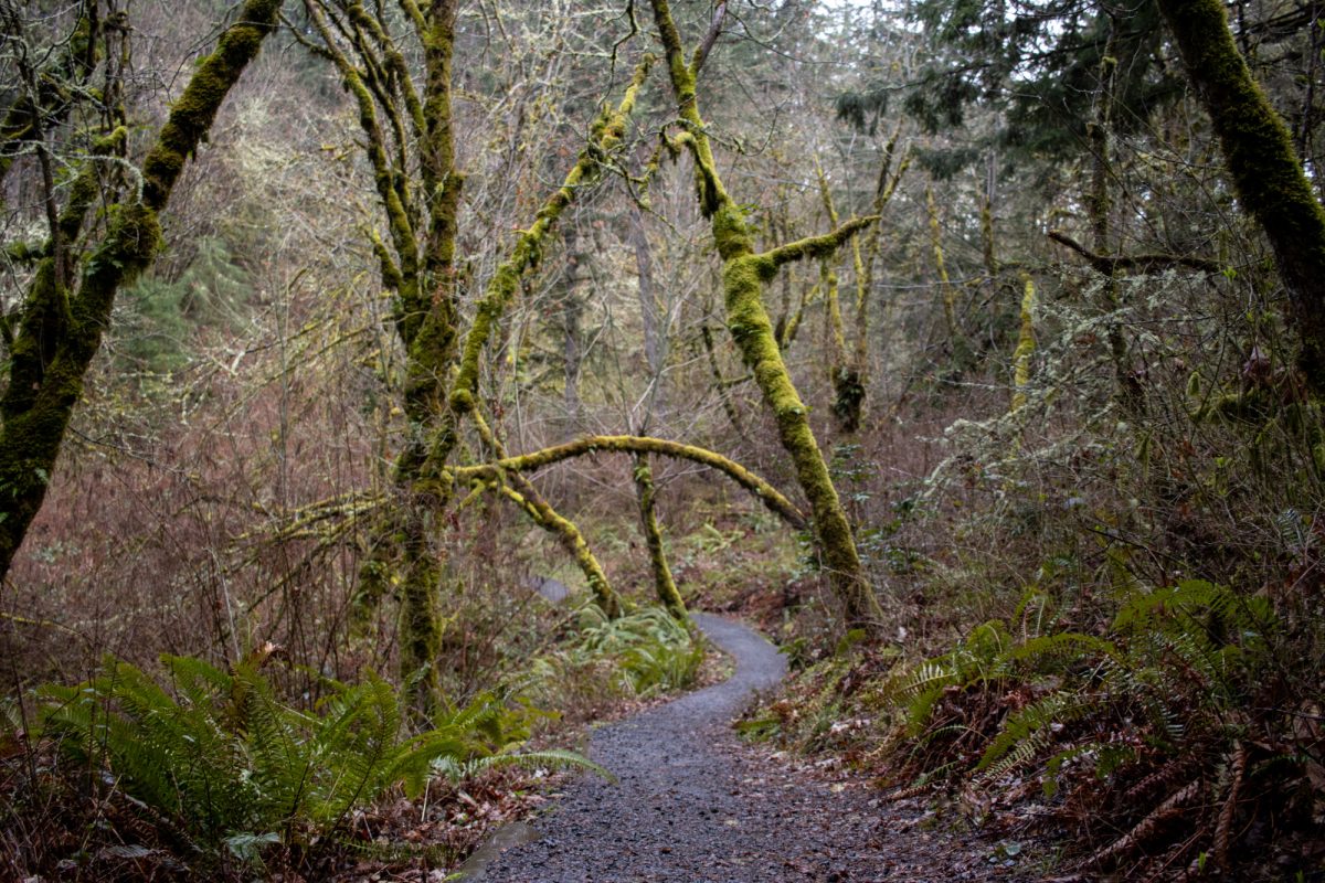
Close to Home: The Ridgeline Trail System
Length: ~12 miles, varies based on route
Elevation Gain: ~2,100 feet, varies based on route
Location: South Eugene
If you’re looking for a choose-your-own-adventure, the Ridgeline trail system is your friend. Walk through meadows and forest on the well-maintained dirt pathway forming a half-circle around Eugene’s southern neighborhoods.
Choose to summit Mount Baldy, or enjoy the changing fall leaves of the Fox Hollow sections. Use any of the seven trailheads to begin your hike, or go end-to-end! With the plethora of other trails branching off toward Erin Noble Headwaters Park, Spencer’s Butte and South Eugene Meadows, the Ridgeline trails are perfect for a nearby and straightforward day hike of any length.
No permits are required and trails are open between 6 a.m. to 11 p.m.
For the Views: Horse Rock Ridge Trail
Length: 4.26 miles
Elevation Gain: 1,164 ft
Location: Shotgun Creek Recreation Site
Approximately a 45-minute drive southwest of campus is a ridgeline trail with beautiful views of the Willamette Valley. The last eight miles are on a fairly well-maintained paved road, navigating through Shotgun Creek Recreation Site to the trailhead. Be alert when the road narrows and when going around blind corners, especially on weekends, as traffic increases.
After parking (free, no pass required), follow the wide gravel track through the large yellow gate and proceed until the path is obstructed by cut trees. Either navigate through the brush on the left of the debris, or walk along the trees themselves to find the path again.
The next half mile is a gentle uphill along a forested track. Watch for mushrooms that have sprung up from the mossy ground. Elevation gain begins when the trail opens onto the more exposed ridge. Early views also open to the south. Listen for raven calls, and look for the red bark of common manzanita shrubs.
Just over a mile into the hike, the path will once again cut into the trees. Stay on the trail to circumvent a small electrical facility. Watch for signs saying “Closed Circuit TV.” At the trail’s end, enjoy views to the east and west beforereturning the same way. Look for snow-capped mountains to the southeast.
On weekends, the parking lots can get busy. Those seeking a bit of alone time may want to arrive earlier to avoid the crowds. Make sure to download a map of the trail before heading out, as service is spotty in the recreation area.
Day Trip: Sawtooth to Mount June
Length: Seven miles
Elevation Gain: 2,200 feet
Location: Umpqua National Forest
Just 50 minutes northwest of campus is a more strenuous hike with rewarding views of the Three Sisters and western valleys.
A paved road leads to the parking lot. Park for free, cross the road and follow the trail to the right. Be sure to take valuable items with you before leaving, as car break-ins have been reported in the area.
A gradual forest hike leads you deeper into the thick woods of Umpqua National Forest. Keep an eye out for wildlife here, including bears. Around the two-mile mark, choose to keep right or to take a left toward the short but viewless Sawtooth Rock excursion.
Enjoy the mossy trees before the trail’s final demanding ascent. The summit boasts views to the west of Sawtooth Rock and Hardesty Mountain (4200 feet). Consider picnicking on the spacious slopes before returning down the same path. Download a map of the trail prior to your trip, as service is generally poor in the forest.


Mike • Jan 6, 2026 at 3:00 pm
Shotgun Creek is Northeast of campus, not Southwest. Sawtooth and Mount June are Southeast of campus, not Northwest. At least you got the Ridgeline Trail right.